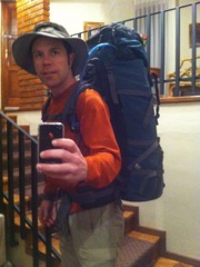
Awake a 5am and ready for the two-day hike. I have a two-person tent, 0C sleeping bag, 5 liters of drinks, all my food, and plenty of warm clothes for this two day hike.
|
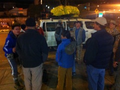
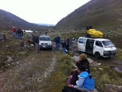
Everybody arrived at the rendezvous point on-time. Bags are packed on top of the van and protected from rain. Ready to leave La Paz at 5:45am.
|
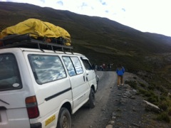
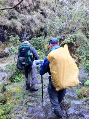
As we approach the trailhead, the road gets steeper and the driver asks us to get out and walk a couple stretches. Very cold up here at this hour...
|
|
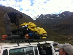
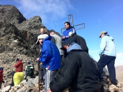
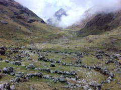
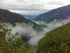
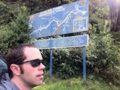
After the two hour drive in, we found ourselves at 4250m (14,000ft!) ready to begin the hike. Nice views up here and good weather so far.
|
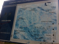
Even now after completing the hike, I can't follow this map at all. Even the distance is not correct, because we hiked about 25km...
|
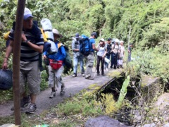
Other groups were arriving at the same time, but it wasn't too busy considering the Easter holiday weekend. Let's go!
|
|
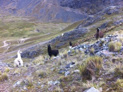
The llamas look confused even though they must see hikers pass here every day...
|
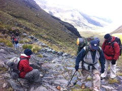
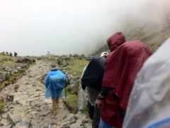
The first 2km took us up almost 400m, with an average incline of nearly 20%! Many of us were regretting our large and heavy bags already, but the warm clothing was important.
|
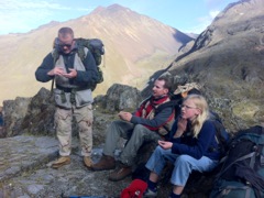
At this altitude, sun screen is a must for all white folks like us. We had a group of over 15 including two kids under 18 and a bunch of others in their 40s and 50s. I was the youngest and maybe fittest of the adults.
|
|
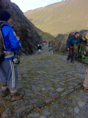
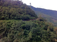
Here you can see the steepness fo the climb. Look at the quality of this road which is at least 600 years old!
|
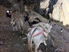
You can arrange to hvae donkeys carry your stuff, especially up these steeper parts. These donkeys seemed to be just hanging-out though.
|
Just trying to show how steep the climb was. All of my photos are a bit strange because I was using the HDR feature on my iPhone which tries to blend three exposures into one perfect photo… with strange shadows.
|
|
After about 90 minutes of climbing, we arrived at 4650m (15,250ft). Surprisingly, it was not too windy and the weather was still beautiful.
|
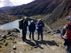
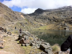
From here, it is all downhill. Nice lagoon below and beautiful sceneary below.
|
A couple guys brought fly fishing rods but didn't manage to catch anything here. I enjoyed a bit of sunbathing while the others ambled down the trail.
|
|
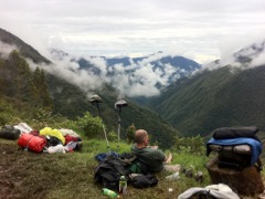
Heading into a marshy valley here. Still only 10:30am with lunch ahead of us and an early arrival in camp.
|
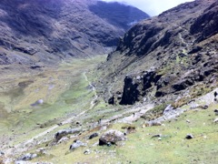
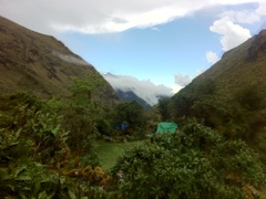
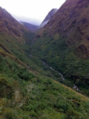
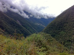
Further down this beautiful green valley. Unfortunately, clouds were blocking the view further down and it started to smell like rain...
|
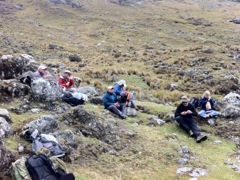
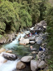
Lunch in the green paradise. We have already descended 600m, so we are just above 4000m (13,100ft) at this point. Everyone is in good spririts, but the last two hikers are far behind already.
|
|
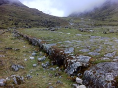
This section helps you appreciate the Inca workmanship. This raised road is about 3m (10ft) across and is just one of the highways in the Inca Road System which covered 40,000km from Ecuador to Argentina!
|
We are descending into the Yungas ("warm lands" in the local language) where there is plenty of rain and warmth, and even Adean bears!
|
It starts to rain after lunch, but just a small drizzle really… enough to break-out the rain gear.
|
|
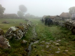
Passing through the village of Takesi, the namesake of this part of the Inca Trail. There was lunch for sale here but we carried on.
|
I wish my photos were better, but maybe you can imagine the beauty of all this green and the amazing quality of the trail.
|
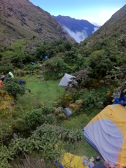
The rain stopped and we settled in at one of the popular camp spots just after 1pm. We walked almost 10km in 6 hours and were still at 3636m (11,939ft). Could be cold at night...
|
|
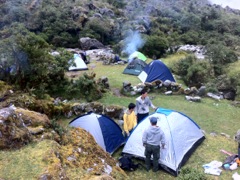
This camp is just after a small bridge across the river that runs down the valley. There are lots of little meadows with just a few trees to block the wind. My tent is in the middle.
|
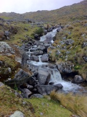
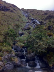
Another waterfall near the camp. We spent the afternoon just relaxing and wandering around the area.
|
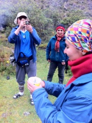
One person from our group was celebrating her birthday out on the trail with us. Somebody improvised a cake with candles. I had ramen for dinner.
|
|
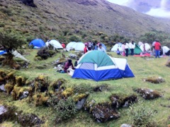
By 6pm more people streemed into the camp. Easter weekend is one of the busiest times on the trail and over half of the groups are high school students out for a little adventure. We started to wonder if we could sleep at night...
|
Some of the kids brought stereos, guitars, and other party starters. Luckily the sound of the rushing river drowned out the sound of any revelers.
|
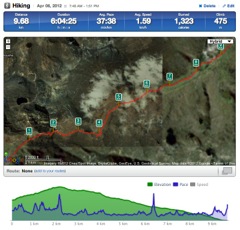
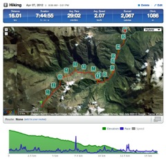
Here is my GPS track of day one. Click the link to go to Runkeeper where you can zoom-in and check altitude and different stats along the track.
|
|
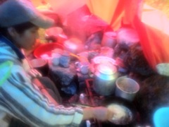
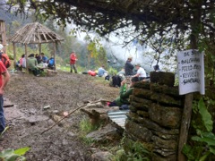
Started raining just after 6am and I realized that my tent fly was no longer working. I packed up and headed for breakfast at this makeshift kitchen staffed by locals.
|
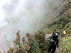
Apparently the Inca did not consider the fact that rain makes the stones super slippery. Or maybe the Inca had better shoes? We passed one girl who had twisted her ankle. Every fell multiple times on day two.
|
This steep section was especially slippery, so I stopped to take photos of anyone who might fall. Luckily the birthday girl made it through unscathed.
|
|
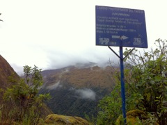
These signs were helpful in adding a little info about the history and the places. This one says the area is named "place where the Andean bear lives!"
|
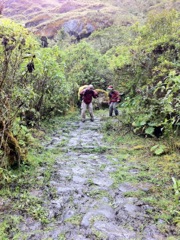
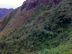
The trail got much more narrow as we headed into these rugged parts along the hillside. Lots of up and down and still very slippery.
|
Water pouring in from every valley but no bears to be found.
|
|
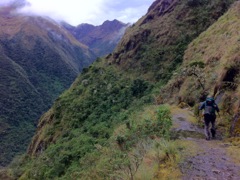
More beautiful walking. The rain let-up, but the trail was still slippery. I wish I had brought my walking poles like Roger.
|
The clouds clear for a bit and it looks like we could continue walking like this to infinity :)
|
Another dangerous spot, but I didn't catch any falls on camera. Also note that the clouds came back in. This is about 2 hrs into the second day of hiking.
|
|
After about 3 hours of descending the treacherous trails, we arrived at our lunch spot. This was just short of the half-way mark of our 16km day. We had descended almost 1000m (3000ft) to 2775m (9,100ft).
|
When we arrived, all but one menu item was available, but the little lunch stop quickly ran out of fried chicken and sandwiches. There must have been hundreds of people still coming behind us, so I hope they had food.
|
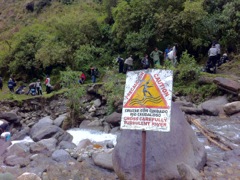
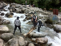
I think someone fell-in here, because shortly after this spot we passed a stretcher being carried out (7km?) by about eight guys. There used to be a suspension bridge, but now the 3 logs on the right are the only bridge.
|
|
These two guys seemed to be part of the rescue unit carrying the stretcher. They helped part of our group across the makeshift bridge.
|
Finally we see the destination: Chojlla Mine. We just have to descend to the river again and walk along the other side of the valley.
|
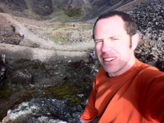
And by 2pm we arrive at the lowest point on the trail: 2155m (7070ft). It might sound like all this downhill hiking is easy, but it is really a killer on the legs, especially if you are carrying a lot of gear. The cool river is a nice reward!
|
|
Yes, there was a lot of traffic this weekend. Everyone trying to decide if they would rather swim in the river or make it out by dark.
|
Arrival! The map at the other end of the trail is easier to understand, and not because it is translated to English. I hear they still mine tungsten at Chojlla.
|
Could that be our van waiting over yonder to take us back to La Paz? No, part of the group had to hike up to the mine to find the driver. After over 4hrs driving up parts of the "Death Road" we arrived back home. Sixteen slippery kilometers on day two, but still a great experience.
|
|
Here is my GPS track of day two. Click the link to go to Runkeeper where you can zoom-in and check altitude and different stats along the track.
|
|